


FERSCHMUSS-LAC ALTENWEIHER

patrickbeyrath
User
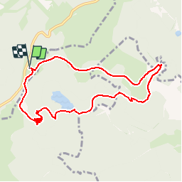

Length
8.3 km

Max alt
1264 m

Uphill gradient
379 m
Km-Effort
13.4 km

Min alt
922 m

Downhill gradient
380 m
Boucle
Yes
Creation date :
2018-10-13 05:53:21.773
Updated on :
2018-10-13 05:53:21.783
2h52
Difficulty : Medium

FREE GPS app for hiking
 SityTrail
IGN / Geographical institutes
SityTrail Plus
The world is yours!
About
Trail Walking of 8.3 km to be discovered at Grand Est, Vosges, La Bresse. This trail is proposed by patrickbeyrath.
Positioning
Country:
France
Region :
Grand Est
Department/Province :
Vosges
Municipality :
La Bresse
Location:
Unknown
Start:(Dec)
Start:(UTM)
349889 ; 5320222 (32U) N.
Comments